Waypoints, what are they?
Anyone who has went through flight school has at some point needed to navigate from A to B. In reality though, you very rarely fly from point A to point B in a dead straight line, instead you usually fly over several points, or waypoints on your way to reach B. Why is this? Well, as pilots, it’s easier to navigate in small chunks for a few reasons:
- With smaller legs, unknowns like wind changes or compass deviations etc will have less of an affect on your bearing over shorter legs
- It’s easier, and safer, to fly to points of reference as you can keep your head out of the cockpit and fly towards (or along) your points of reference (cities, landmarks etc)
- There are more than likely obstacles along the direct path such as mountains, cities, airspace and wind turbines forcing us to go around
So there is no way to avoid waypoints as a pilot, and it turns out they are fairly useful things. So, what do they look like?
SkyDemon waypoints
So now we know what waypoints are and why we use them, lets turn to my navigation software of choice, SkyDemon. This is an app that runs on all tablets (with GPS), phones and even PCs and is excellent for VFR planning and navigation.
I plan on releasing a post on how I use SkyDemon for flight planning in the not too distant future.
So lets take a look at some built in waypoints using a flight log from my [flight to Causeway Airfield](https://leftdownwind.co.uk/articles/causeway-airfield-a-gem-on-the-north-coast/).
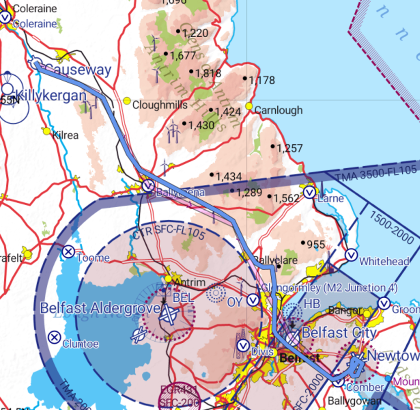
Explaining the symbols
So here we have a few of the built in waypoints SkyDemon provides us, I have used them to plan my route as can be seen by the faint magenta line starting at the top left, it goes from airfield to town (visual reference point in this case), to town, to airfield and into my destination airfield Newtownards.
Here we can see some built in waypoints:
- Airfields; those with the rectangles cutting through them are paved, those without are grass
- V which denotes a visual reporting point
- Yellow dots which are towns
- Parachute symbols in the top left
- Abandoned airfields; circles with the x through them
Each one of these we can use to plan our route by simply dragging the magenta line onto them at which point the line sticks, magic!
But what do we do if there is a waypoint missing, perhaps it’s a private airfield or a point of interest you wish to visit, well, that’s where User Waypoints come in.
User Waypoints
These are waypoints we, as SkyDemon users, can define ourselves, SkyDemon calls them User Waypoints but I tend to call them Custom Waypoints for some reason! They are a really simple yet powerful feature and I use them for a few things:
points of interest; could be historic monuments or small towns not in SkyDemon by default
private airfields; small grass private airfields, not listed on the maps
Like the built in waypoints, once placed, you can navigate to them using the same dragging and dropping of the magenta line, excellent!
Getting Co-Ordinates
Before we can start creating the waypoint, we need the co-ordinates of the location we are interested in. If you know these in advance, great! If not, you can use a service like LatLong.net to either search for your location or drag a pointer along a map until you find your point. At this stage it will give you the co-ordinates in a couple of formats, it’s the Lat Long Co-Ordinates we are interested in the bottom left in as that’s the easiest format SkyDemon requires.

As we can see I want to find the location of the Giants Causeway as I want to add that to SkyDemon, so using LatLong.net I simply searched for it and it brought up the correct location along with the co-ordinates.
What I’ll be adding to my user waypoint will be:
55.240807,-6.511555
Creating a waypoint
Now we’ll go step by step into adding a User Waypoint to your SkyDemon, so make sure you have it open. Note, I’m using an Android tablet for the screenshots.
- Click the settings cog, which is on the top left of the toolbar
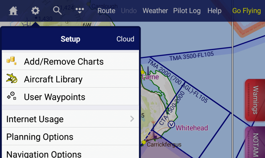
Tap on the User Waypoints option
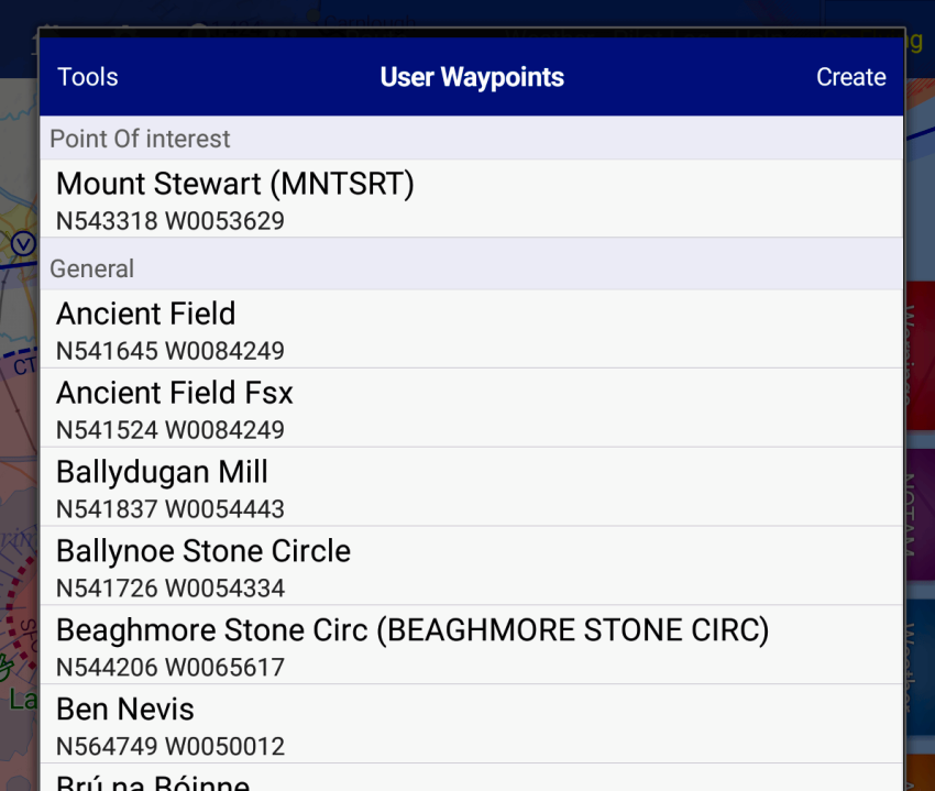
As can be seen, I have a lot which I copied over from another pilot. Click on the Create button on the top left
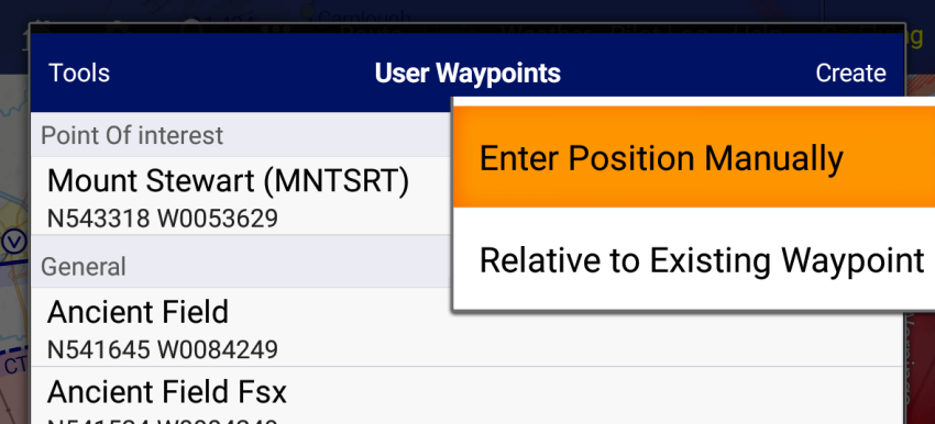
- I’m going to add the Giants Causeway which I searched for earlier, so click on Enter Position Manually
- Give the waypoint a name, in this case Giants Causeway will be perfect, add the co-ordinates as shown above.
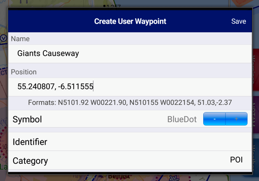
You can then give the waypoint a symbol, I chose blue dot in this case and created a new POI category
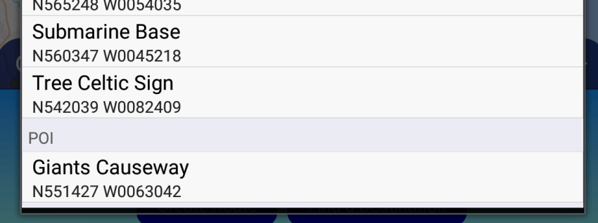
Tap Save and you will then see the new waypoint in your list, nested under the Category you created, if you added one
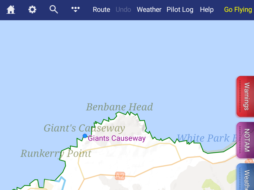
- Looking on the map the waypoint is now there for future use!
Done!
So now your waypoint is added it will be there every time you open SkyDemon in future and you can use it just like the built in waypoints, which is fanastic!
Don’t forget to backup
The final take away from this is to backup your settings as you wouldn’t want to loose all your waypoints if you loose your device or it breaks. Back at the waypoint list, click the Tools button on top right and tap on Save to Cloud, hit Yes on the dialog that appears and your waypoints will be safely stored in the cloud for you to pull down whenever you need it!
Wrap up
So that’s all there is to it and so ends my first tutorial on here. Hopefully you found it easy to follow, I’m open to feedback and if there’s anything you’d like clarified or would like a tutorial on let me know, either in the comments below, or, by contacting me on Facebook, Twitter or Instagram!